In the past year, the Fishers Island Conservancy has begun a new project: Beach Profiling for Coastal Management. As concern for the island’s southern coast has risen over the years with the threat of worsening storm surges and longer hurricane seasons due to climate change, researchers at the Conservancy have embarked on a new project to understand this dynamic coastline.
In the fall of 2024, Intern, Elsie Harrington, with the support of Stephanie Hall, dove into research on how we can track and manage the seasonal erosion (losing land mass) and deposition (gaining land mass) of sediment on Fishers Island’s southern coast. Through this, she learned of a project conducted on Block Island using the Emery Method of Beach Profiling led by Professor and Department Chair of Environmental Earth Sciences at Eastern Connecticut State University, Dr. Bryan A. Oakley. Enthusiastic to expand this research, Oakley, Harrington, and Hall teamed up to bring this project to Fishers Island. Nicolas Hall soon joined the project as well, assisting in developing a plan for implementation and writing a proposal for the FIC Board.
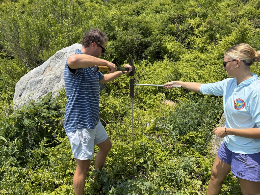
Interns Elsie Harrington and Nick Hall installing poles
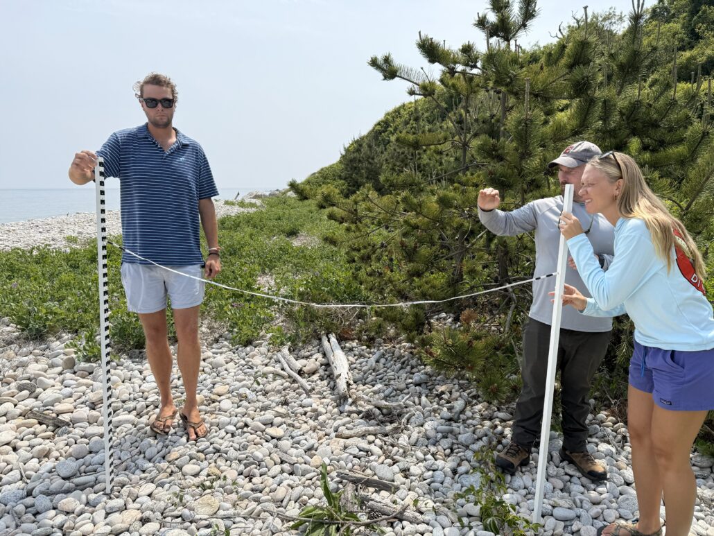
Interns Elsie Harrington and Nick Hall with Dr. Bryan Oakley
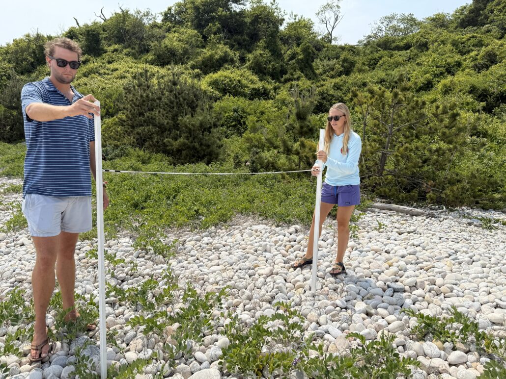
Interns Elsie Harrington and Nick Hall
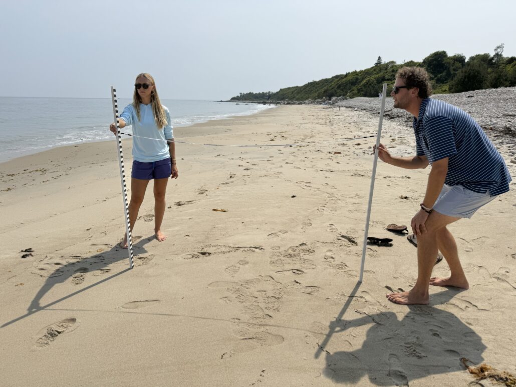
Interns Elsie Harrington and Nick Hall
What is Beach Profiling?
What is beach profiling? Essentially, beach profiling is a way to take a look at a “slice” of a beach, from the vegetation, across the cobble and sand, all the way to the ocean. Using the Emery Method, created by K. O. Emery in 1961, this method requires the use of two rods or sticks with measurements marked every two centimeters, connected by two meters of measuring tape/rope. The process involves tracking the change in elevation of the beach by reading the alignment of the rods based off the horizon. This method, when consistently practiced, can track changes in the profile over short and long periods of time. We can observe the change over a year that may be caused by natural seasonal depositional differences versus changes over ten years that may be caused by more intense storm surges and potential climate change factors.
Where We Are Now
With this project now wrapping up its first year, we have gathered over 20 profiles across the southern shore of Fishers Island. Currently, there are four profiling sites – South Beach, Isabella Beach East & West, and Chocomount Beach. With these four locations, we will continue to create a baseline of profile data, and as the years go by, we can track the changes we see in our beaches. Specifically for Fishers Island, this could help us to catch potential trends in erosion that home and land owners on our southern coastline need to be aware of.
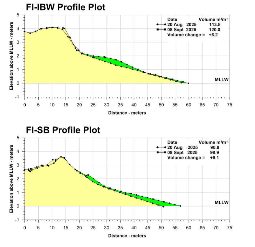
Below are examples of outputs of the data gathered in the field when inputted into Oakley’s program. We have used short-hand descriptions of the profiling sites here: FI-IBW meaning Isabella Beach West, and FI-SB for South Beach. There are just two examples comparing two separate profiles taken on 8/20/25 and 9/8/25. In each of these diagrams, we can see a layer of deposition (shaded in green) that is typical for the incoming fall storm surge season. These winds and waves usually change the appearance of our beaches quite dramatically throughout the fall and the rest of the year.
Previous shoreline research
In 2012, a comprehensive shoreline erosion study was prepared for the Fishers Island Conservancy by coastal engineers W.F. Baird & Associates. The study examined long term changes along the island’s south shore using historic aerial imagery, beach width measurements, storm history, and high resolution LiDAR data. Together, these analyses documented patterns of bluff retreat, beach narrowing, and storm driven variability, and established a detailed baseline for understanding shoreline change on Fishers Island.
The current beach profiling effort builds on this earlier work by focusing on simple, repeatable field measurements at a small number of beaches. Rather than re-studying long term trends, beach profiling is intended to track seasonal and storm related changes over time and to support ongoing observation and stewardship of the island’s shoreline.